Hotel Nevada in Ely. I didn't stay there but went to the cafe for a few meals.
Today's summit was Connor Pass - 7700'
Warm springs swimming area after a hail storm.
Wild horses at a creek across from a host's place.
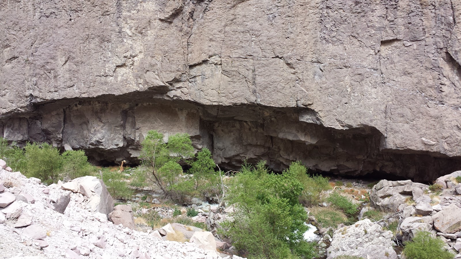
Fenced off hot spring pool. You can still get in and the water is quite hot.
Saturday, May 23, 2015
Thursday, May 21, 2015
Did I say 'summit'? Arriving in Ely, NV - thanks to a great deal of help from a visiting friend from home, and a local family!
Ely, Nevada reminds me a little of Truckee, CA, where I spent several working winters. The altitude is similar, I think, at about 6400'. There are mountains all around, some of then snow-capped. Temperatures have been on the brisk side and the weather is changeable. I'm told that they have had an unseasonable amount of rain this spring; it has rained off and on every day so far, and certainly is crowding the forecast as I try to figure out what day would be advantageous for departure. To top it off, on my last night of camping the new-this-year REI tent snapped a pole(!) right where the repair piece that comes with it was rendered useless... Bungee cords and merciful weather helped that night, and the timing was actually quite fortunate in that the tent can be replaced here in Ely. After consulting at length about repair possibilities there didn't seem to be a choice. Another 'letting go' opportunity!
The expanse between Tonopah and Ely is about 170 miles, with no services. There were 4 summits to climb in that stretch and there will be two more between here and the Utah state line. (Nevada is the most mountainous state in the lower 48.) As mentioned last post, my support team of one(!) came from San Francisco to meet me in Tonopah, and helped me across the first part. After that I was 'handed off' (with logistical help from the mail carrier!) to a local lady who lives in the Railroad Valley area, and she took care of me as I walked for the next few days before her son and daughter-in-law (who live on the east side of the same valley) took over! Thanks to these generous folks, I slept in a bed for another week after I left Tonopah, and got spoiled with meals and showers every day.
Contrary to common assumption, the high desert is not flat, although there are flat stretches (some of them extensive) between mountain ranges. It is also called the 'Sagebrush Sea' and covers parts of many of the western states. I have seen wild horses and bighorn sheep, many flowering desert plants, and at moments have been stopped in my tracks by unfamiliar and elaborate birdsong. Here and there hot/warm mineral spring creeks flow down from the mountains. In and between towns, defunct ranches and shuttered businesses stand, along with refurbished 19th/20th century hotels, expanding oilfields and mining operations, all of it bearing witness to rising and falling fortunes, and people moving on.
Also contrary to common assumption (mine, at least) there are plenty of people who are concerned about climate and its effect on economy, among other things. These days a certain awareness of the impact of human activity on our environment seems to cut across the range of political persuasions. It has been surprising to encounter hunters/gun enthusiasts, rodeo professionals, ranchers and hard working tradespeople, who, like me, also want to see money kicked out of politics and are concerned for their children's future, what with the abuse of shrinking global resources and the competition and violence that so often comes with it... I have been very moved by many gestures of support and feel blessed to have this opportunity to connect with people; we have much more in common than we are generally given to believe!
(Sorry! For some reason photos don't want to attach this time. Will try again when I have a chance!)
The expanse between Tonopah and Ely is about 170 miles, with no services. There were 4 summits to climb in that stretch and there will be two more between here and the Utah state line. (Nevada is the most mountainous state in the lower 48.) As mentioned last post, my support team of one(!) came from San Francisco to meet me in Tonopah, and helped me across the first part. After that I was 'handed off' (with logistical help from the mail carrier!) to a local lady who lives in the Railroad Valley area, and she took care of me as I walked for the next few days before her son and daughter-in-law (who live on the east side of the same valley) took over! Thanks to these generous folks, I slept in a bed for another week after I left Tonopah, and got spoiled with meals and showers every day.
Contrary to common assumption, the high desert is not flat, although there are flat stretches (some of them extensive) between mountain ranges. It is also called the 'Sagebrush Sea' and covers parts of many of the western states. I have seen wild horses and bighorn sheep, many flowering desert plants, and at moments have been stopped in my tracks by unfamiliar and elaborate birdsong. Here and there hot/warm mineral spring creeks flow down from the mountains. In and between towns, defunct ranches and shuttered businesses stand, along with refurbished 19th/20th century hotels, expanding oilfields and mining operations, all of it bearing witness to rising and falling fortunes, and people moving on.
Also contrary to common assumption (mine, at least) there are plenty of people who are concerned about climate and its effect on economy, among other things. These days a certain awareness of the impact of human activity on our environment seems to cut across the range of political persuasions. It has been surprising to encounter hunters/gun enthusiasts, rodeo professionals, ranchers and hard working tradespeople, who, like me, also want to see money kicked out of politics and are concerned for their children's future, what with the abuse of shrinking global resources and the competition and violence that so often comes with it... I have been very moved by many gestures of support and feel blessed to have this opportunity to connect with people; we have much more in common than we are generally given to believe!
(Sorry! For some reason photos don't want to attach this time. Will try again when I have a chance!)
Wednesday, May 6, 2015
Objects in the distance are further away than they appear...
Walking and walking... how could it be that that it's already late afternoon, and somehow I am no closer to that range of hills I've been approaching for hours? I am learning once again from this high desert walking experience (where distances matter) that, indeed, perception of distances can be very deceiving -- whether this is due to altitude, heat, airborne dust or a combination of it all I do not know. Sudden changes of temperature, wind velocity and direction are to be expected. Some days begin easily enough and I am working a lot harder than I like by afternoon. But we (my trailer and I) keep on trucking and are sometimes greatly rewarded with mercifully sheltered camping sites, and generous people bearing 'care packages'!
The road between Bishop and Tonopah was highlighted by a couple of days (one of them donated!) at Benton Hot Springs -- so healing and relaxing; crossing into the state of Nevada and reaching the top of Montgomery pass that same day, at more than 7000'; and a gift/drop of food and water from some road angels from Chalfant Valley, CA. There is a stark beauty about this undulating and unforgiving terrain; my ability to appreciate it varies considerably, but the 'awesomeness' factor is a constant.
For some days the road shoulders have been quite narrow. I am trying to learn the art of walking on/around 'rumble strips', important safety features for vehicles, but brutal on walkers with trailers like mine! It/she (the trailer) can just about straddle the bumps, and sometimes there is enough paved space for us to the right of them. In either case it involves constant staring at the ground so as to avoid the jarring bumpiness. Or I can simply walk to the left of the white line and hope that traffic will move over! Goodness knows I am visible at a great enough distance. (See photo)
Arriving in Tonopah I was immeasurably blessed with an offer of backyard camping, with all of the comforts of home! A Nevada DOT 'road angel' (in more ways than one!) and his family have taken me in for a few days while I wait for a friend from SF, coming to provide vehicle support for the next stretch. (OK, 'vehicle support'. What does that mean? I will continue the walk, at a 'do-able' number of miles per day sans trailer, and return to a base in Tonopah at the end of each day, with rides to and from…) In this interim I am enjoying exploring the town and relaxing!
The road between Bishop and Tonopah was highlighted by a couple of days (one of them donated!) at Benton Hot Springs -- so healing and relaxing; crossing into the state of Nevada and reaching the top of Montgomery pass that same day, at more than 7000'; and a gift/drop of food and water from some road angels from Chalfant Valley, CA. There is a stark beauty about this undulating and unforgiving terrain; my ability to appreciate it varies considerably, but the 'awesomeness' factor is a constant.
For some days the road shoulders have been quite narrow. I am trying to learn the art of walking on/around 'rumble strips', important safety features for vehicles, but brutal on walkers with trailers like mine! It/she (the trailer) can just about straddle the bumps, and sometimes there is enough paved space for us to the right of them. In either case it involves constant staring at the ground so as to avoid the jarring bumpiness. Or I can simply walk to the left of the white line and hope that traffic will move over! Goodness knows I am visible at a great enough distance. (See photo)
Arriving in Tonopah I was immeasurably blessed with an offer of backyard camping, with all of the comforts of home! A Nevada DOT 'road angel' (in more ways than one!) and his family have taken me in for a few days while I wait for a friend from SF, coming to provide vehicle support for the next stretch. (OK, 'vehicle support'. What does that mean? I will continue the walk, at a 'do-able' number of miles per day sans trailer, and return to a base in Tonopah at the end of each day, with rides to and from…) In this interim I am enjoying exploring the town and relaxing!
![]() |
| Sign outside of Bishop, CA |
![]() |
| Boundary Peak - 13,141' |
![]() |
| Rumble strips |
![]() |
| Historic Tonopah Cemetery |
![]() |
| Taken from the hilltop mining museum site - in the distance (about 12 miles) you can see a rest area where I camped the night before arriving in Tonopah. |
![]() |
| At the Central Nevada Museum |
Saturday, April 25, 2015
Inconvenience? Set-back? Opportunity?
I am presently located very conveniently, across the street from the city library in Bishop - with time on my hands and the opportunity to post a few photos. Although I must confess that my enthusiasm for the task has suffered a little.
The walk is proceeding at little more then a crawl just now! New boots arrived at the Post Office in Lone Pine, and within a few miles I found myself noticing several problems that worsened over the following days. The foot issues don't bear too much description, and I haven't the heart for it anyway. But I have been stalled once again, with some wounds that needed healing, and the on-going quandary of what to do about footwear! Luckily there is a good hostel here (Hostel California!), and plenty of outdoor gear/sporting goods stores that service the many Eastern Sierra hikers and climbers. The scenery is still breath-taking - mountains to the east and the west. Yesterday I was treated (by fellow hostelers with a car!) to a day of sight-seeing/walking on some gorgeous hiking trails in the vicinity. Tried out a pair of running shoes without further damaging repercussions...
One very interesting and worthwhile detour between Lone Pine and Independence was a stop at the former Japanese internment camp at Manzanar. The site is extensive and very evocative, and the Nat'l Park Service has done a great job of putting together the museum and introductory video. I spent a couple of hours there and could have stayed longer.
Bishop represents another turning point; in just a couple of miles I'll be on U.S. Route 6 - a route I could conceivably follow all the way to New England! The Nevada state line is about three days walk from here (at my speed and inclination!), and in Nevada there will be great stretches of lonely highway, devoid of services, or so I hear... Maybe I do need extra time in Bishop just to breathe slowly and deeply, and take that in! A very great blessing and comfort is that I will have some vehicular support for a few days starting in Tonopah, NV. Have also been in touch with a Nevada resident I will be visiting next month, in the middle of the longest stretch between towns.
The walk is proceeding at little more then a crawl just now! New boots arrived at the Post Office in Lone Pine, and within a few miles I found myself noticing several problems that worsened over the following days. The foot issues don't bear too much description, and I haven't the heart for it anyway. But I have been stalled once again, with some wounds that needed healing, and the on-going quandary of what to do about footwear! Luckily there is a good hostel here (Hostel California!), and plenty of outdoor gear/sporting goods stores that service the many Eastern Sierra hikers and climbers. The scenery is still breath-taking - mountains to the east and the west. Yesterday I was treated (by fellow hostelers with a car!) to a day of sight-seeing/walking on some gorgeous hiking trails in the vicinity. Tried out a pair of running shoes without further damaging repercussions...
One very interesting and worthwhile detour between Lone Pine and Independence was a stop at the former Japanese internment camp at Manzanar. The site is extensive and very evocative, and the Nat'l Park Service has done a great job of putting together the museum and introductory video. I spent a couple of hours there and could have stayed longer.
Bishop represents another turning point; in just a couple of miles I'll be on U.S. Route 6 - a route I could conceivably follow all the way to New England! The Nevada state line is about three days walk from here (at my speed and inclination!), and in Nevada there will be great stretches of lonely highway, devoid of services, or so I hear... Maybe I do need extra time in Bishop just to breathe slowly and deeply, and take that in! A very great blessing and comfort is that I will have some vehicular support for a few days starting in Tonopah, NV. Have also been in touch with a Nevada resident I will be visiting next month, in the middle of the longest stretch between towns.
![]() |
| The Hostel California |
![]() |
| Manzanar Museum |
Thursday, April 16, 2015
Lone Pine, and some photo 'catch-up'...
Here I am in the town of Lone Pine, patiently awaiting delivery of a new pair of boots. It seems unbelievable to have completely worn down the heels of my almost new Keens in a matter of weeks! Nice town to be exploring while I wait, quite conducive to patience... Beautiful countryside around here at the base of Mt. Whitney.
Also unbelievable -- very high winds the other night, and fact that my tent was not flattened. Spent a good part of yesterday cleaning up the grit that got into all of my gear!
Today, thanks to some very serendipitous rides to and from the trailhead, I got a hike up to Lone Pine Lake, on the trail to the Mt. Whitney summit. The elevation at the lake is almost 10,000' (I was surprised to discover.) It was a toss-up as to whether I stopped so often to take photos due to a need to catch my breath, or from sheer amazement at the breath-taking views. Serious mountains up here!
Also unbelievable -- very high winds the other night, and fact that my tent was not flattened. Spent a good part of yesterday cleaning up the grit that got into all of my gear!
Today, thanks to some very serendipitous rides to and from the trailhead, I got a hike up to Lone Pine Lake, on the trail to the Mt. Whitney summit. The elevation at the lake is almost 10,000' (I was surprised to discover.) It was a toss-up as to whether I stopped so often to take photos due to a need to catch my breath, or from sheer amazement at the breath-taking views. Serious mountains up here!
Sunday, April 12, 2015
Turning the corner!
Learning about love and attachments, resistance and denial. Always about gratitude. And the practice of recognizing the relationship between values and judgments. So far my instincts/intuition have proved to be reliable. And sometimes a little bit painful!
Arrived yesterday in the town of Inyokern, where I will change directions for the next few weeks, heading north on Rt. 395 (which is also 'Historic Rt. 6) until they diverge north of Bishop. Had a lovely time in Kernville, with a generous host who, along with her dog and cat companions, made me feel like family. Kernville hadn't been on my route originally, but for several favorable recommendations and a convergence of circumstances!
Came over Walker Pass and camped at the campground there, which intersects with the Pacific Crest Trail. PCT season doesn't officially start for another few weeks, but I was blessed to find that the 'trail angels' were out already! Great thanks to more Bodhisattvas of the road!
Still have intermittent cell service; they say it will be spotty up Rt. 395. Boot heel treads totally gone after this first 3 weeks!! Will be looking for a delivery of some new (and, I hope, more durable ones) in Lone Pine.
More photos to follow; so amazing that I cannot get them attached, after more than an hour of trying!
Arrived yesterday in the town of Inyokern, where I will change directions for the next few weeks, heading north on Rt. 395 (which is also 'Historic Rt. 6) until they diverge north of Bishop. Had a lovely time in Kernville, with a generous host who, along with her dog and cat companions, made me feel like family. Kernville hadn't been on my route originally, but for several favorable recommendations and a convergence of circumstances!
Came over Walker Pass and camped at the campground there, which intersects with the Pacific Crest Trail. PCT season doesn't officially start for another few weeks, but I was blessed to find that the 'trail angels' were out already! Great thanks to more Bodhisattvas of the road!
Still have intermittent cell service; they say it will be spotty up Rt. 395. Boot heel treads totally gone after this first 3 weeks!! Will be looking for a delivery of some new (and, I hope, more durable ones) in Lone Pine.
More photos to follow; so amazing that I cannot get them attached, after more than an hour of trying!
Friday, April 3, 2015
First leg -- Arriving in Bakersfield.
A moment of flagging courage: waking up in such a sprawling and relentlessly commercial town, without a car. But a morning coffee and a chat with someone familiar did wonders toward restoring the old morale. And a couple of days of regrouping, supported by the help of several lovely, generous people, have made me feel much more 'at home'!
I do not know exactly how many miles (100+) I have walked now, at the beginning of this rather audacious venture. But I do know that whatever 'rules' I have set for myself are subject to constant adjustment! This is about rising to the immediate occasion, learning to trust, pray/meditate, offer up the many blessings that have come my way already, with a grateful and humble spirit -- and trying not to lapse into crabbiness in moments of panic!
My appearance is unusual, to say the least, walking along with a trailer. Many conversations have ensued and again I find myself wondering about the goals and ideals of this business (beyond my own personal 'calling' to get out here on foot). How would I ever make an impact on anyone's orientation around environment and lifestyle, in the space of a brief conversation? As I've resolved to do, I can only express my concerns and opinions to those who ask about my purpose. And realize (as I enjoy so many kindnesses from others), my own part in the consumption of those resources I'm concerned about!
Many thanks are in order, to the Bodhisattvas of the road! (These are sort of like Buddhist angels or saints, in case anyone's wondering...) I have been offered (among other things) accommodations in Santa Margarita and Buttonwillow, meals on the Carrizo Plain and in McKittrick. Many good wishes have been extended and I have felt overwhelmingly supported by people along the way.
Thoughts on one contrast between the east and west sides of the Temblor range (so called because it runs along the San Andreas fault line) that borders the Carrizo Plains National Monument and divides San Luis Obispo and Kern counties. The land on the Plains side looks fairly unspoiled for the most part (being part of a national monument). But as a prominent feature there are two massive solar farms -- controversial but apparently serving the area well. By contrast, after descending the rolling and wildflower-covered hills on the east side, one drops into a smoggy valley of oil fields and pipeline. Gradually this gives way to agriculture. And this is where I refrain from expressing any opinions on the politics of water and who/what controls the vital information about future prognosis for agriculture and water usage! Suffice it say that both crisis denial and anger toward government are running rampant.
From this point on Internet and phone access may be quite limited. Good luck to me - and to us all!
I do not know exactly how many miles (100+) I have walked now, at the beginning of this rather audacious venture. But I do know that whatever 'rules' I have set for myself are subject to constant adjustment! This is about rising to the immediate occasion, learning to trust, pray/meditate, offer up the many blessings that have come my way already, with a grateful and humble spirit -- and trying not to lapse into crabbiness in moments of panic!
My appearance is unusual, to say the least, walking along with a trailer. Many conversations have ensued and again I find myself wondering about the goals and ideals of this business (beyond my own personal 'calling' to get out here on foot). How would I ever make an impact on anyone's orientation around environment and lifestyle, in the space of a brief conversation? As I've resolved to do, I can only express my concerns and opinions to those who ask about my purpose. And realize (as I enjoy so many kindnesses from others), my own part in the consumption of those resources I'm concerned about!
Many thanks are in order, to the Bodhisattvas of the road! (These are sort of like Buddhist angels or saints, in case anyone's wondering...) I have been offered (among other things) accommodations in Santa Margarita and Buttonwillow, meals on the Carrizo Plain and in McKittrick. Many good wishes have been extended and I have felt overwhelmingly supported by people along the way.
Thoughts on one contrast between the east and west sides of the Temblor range (so called because it runs along the San Andreas fault line) that borders the Carrizo Plains National Monument and divides San Luis Obispo and Kern counties. The land on the Plains side looks fairly unspoiled for the most part (being part of a national monument). But as a prominent feature there are two massive solar farms -- controversial but apparently serving the area well. By contrast, after descending the rolling and wildflower-covered hills on the east side, one drops into a smoggy valley of oil fields and pipeline. Gradually this gives way to agriculture. And this is where I refrain from expressing any opinions on the politics of water and who/what controls the vital information about future prognosis for agriculture and water usage! Suffice it say that both crisis denial and anger toward government are running rampant.
From this point on Internet and phone access may be quite limited. Good luck to me - and to us all!
Subscribe to:
Posts (Atom)


.jpg)